Aquaculture Mapping: Detecting and Classifying Aquaculture Ponds using Deep Learning
Abstract
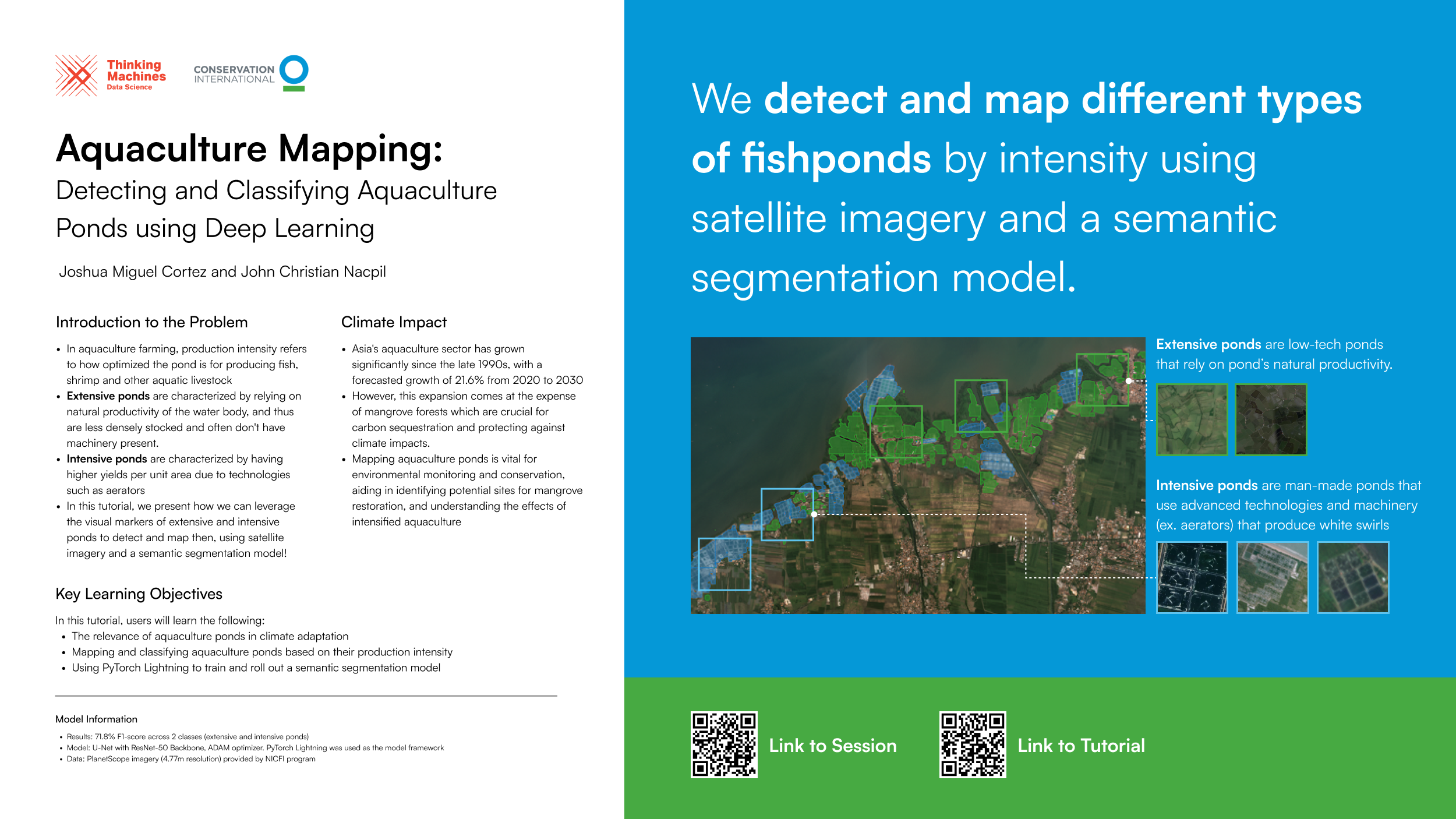
Mapping aquaculture ponds is critical for restoration, conservation, and climate adaptation efforts. Aquaculture can contribute to high levels of water pollution from untreated effluent and negatively impact coastal ecosystems. Large-scale aquaculture is also a significant driver in mangrove deforestation, thus reducing the world’s carbon sinks and exacerbating the effects of climate change. However, finding and mapping these ponds on the ground can be highly labor and time-intensive. Most existing automated techniques are focused only on spatial location and do not consider production intensification, which is also crucial to understanding their impact on the surrounding ecosystem. We can classify them into two main types: a) Extensive ponds, which are large, irregularly-shaped ponds that rely on natural productivity, and b) intensive ponds which are smaller and regularly shaped. Intensive ponds use machinery such as aerators that maximize production and also result in the characteristic presence of air bubbles on the pond’s surface. The features of these two types of ponds make them distinguishable and detectable from satellite imagery.In this tutorial, we will discuss types of aquaculture ponds in detail and demonstrate how they can be detected and classified using satellite imagery. The tutorial will introduce an open dataset of human-labeled aquaculture ponds in the Philippines and Indonesia. Using this dataset, the tutorial will use semantic segmentation to map out similar ponds over an entire country and classify them as either extensive or intensive, going through the entire process of i) satellite imagery retrieval, ii) preprocessing these images into a training-ready dataset, iii) model training, and iv) finally model rollout on a sample area. Throughout, the tutorial will leverage PyTorch Lightning, a machine learning framework that provides a simplified and streamlined interface for model experimentation and deployment. This tutorial aims to discuss the relevance of aquaculture ponds in climate adaptation and equip users with the necessary inputs and tools to perform their own ML-powered earth observation projects.